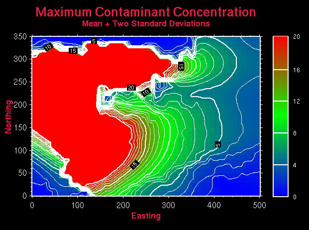
Figure 17.7: This map is the result of two maps added together. In this case, the average contaminant concentration (determined from a series a 100 different geologic interpretations and 100 ground water flow and contaminant transport models) and two standard deviations at each location were added together. This gives a single map indicating, at a 95% confidence level, the maximum likely concentration at any location within the map area.