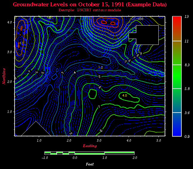
Figure 11.3: This contour map shows several features of contour (file dig.grd). The map was printed with a portrait orientation using blanking and data posting options. Contour lines of variable weight are available, a grid may be overlain, surficial features such as building outlines (rectangular whited-out areas) may be positioned, and the location of important points (assay values, well ID's, etc.) can be identified.