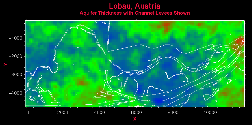
Figure 11.5: In addition to drawing contours, and blanking areas on the map (Figure 11.2), it is possible to draw line work on the map. In this case, the color shading represents the thickness of the aquifer, and the line work shows the position of the river and channel levees.