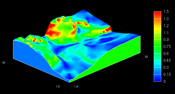
Figure 12.2: This map surface shows a relief surface, where the color coding refers to the steepness, or gradient, of the surface in the area. White is steep, black is flat. This plot was printed with a portrait format.