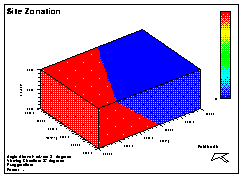
The Problem

Sometimes in a study area, the spatial variation of the data varies across the site. Sometimes the different zones are distinct, and sometimes they are transitional between each other.

These different zones can be caused by changes in depositional processes, unconformities, faulting, etc. Whatever the cause, these area violate a basic assumption of kriging, stationarity.

Traditional Options

1) Ignore the problem, and assume a single averaged model.
2) Model each zone seperately, and merge the results.

Traditional Problems

1) Resultant maps often have sharp boundaries.
2) For each zone, a new set of calculations must be performed.
3) Merging results into the correct zonal distribution takes significant manual handling, particularly when conditional simulation is used.


June 1996